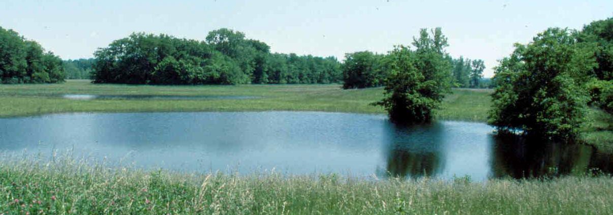
Mound 61
Both Mounds 61 and 62 are in association with a large borrow pit in the southeast quadrant of the site. A recent survey suggests that there is a mound (Mound 95) not noted by Patrick or other investigators on the northeast side of this borrow pit. Patrick shows Mounds 61 and 62 linked by a sort of U-shaped causeway. No recent maps have indicated this, so it is a little difficult to interpret Patrick’s map. On the USGS map, particularly the 1930 compilation from the original field notes, there is a U-shaped topographic feature that may represent Patrick’s configuration. In the spring of 1978, I noted a vegetation pattern between these two mounds that almost matched Patrick’s description.
Patrick does not give a height for this mound. McAdams in 1882 gives 10 feet (3.05 meters), and Peterson-McAdams in 1906, 14 feet (4.3 meters). The 1966 UWM Map, using a 127-meter (416.7 feet) base contour, shows a height of 1.9 meters (6.2 feet).
This area has been extensively cultivated in recent years, and the difference between the heights given by the earlier investigators and the 1966 Map may reflect deflation from intensive cultivation. As a consequence, the borrow pits in the area have undoubtedly filled in since Patrick’s time, although they are still clearly visible in the topography of the area and retain moisture.
The Patrick Map shows Mound 61 as rectangular with a much longer north-south axis. The UWM Map, however, shows this as a long, oval-shaped mound with a much longer east-west axis. Whether the discrepancy is the result of cultivation or an error on Patrick’s map cannot be determined. The east-west orientation is in agreement with Moorehead’s rendering of this mound in his interpretation of the Patrick Map in 1929.
Moorehead gives some indication of the height of Mound 61: “Two pits were sunk and by means of the augers we tested to the base, a distance of 20 feet” (Moorehead 1923: 35-36). Since Moorehead does not define what he considers the base, he may have considered the natural gumbo surface of the area as part of the mound. This might account for the difference in height between the Peterson-McAdams estimate and Moorehead’s.
When Moorehead worked in this mound, he reported the following:
This is an oval mound located between the two ponds on land owned by Mrs. William Tippetts. Externally it is rather promising, and as it is shaped not unlike altar mounds of the Ohio Valley, the survey decided to test it. Much to our surprise we found it composed of exceedingly heavy, black gumbo…. Very little in the way of material was encountered. The mound appeared to be unstratified. [Moorehead 1923: 35-36]
Moorehead goes on to comment on the relationship of Mound 61 to village site material— pottery fragments, bone fragments or broken stone:
The soil around Mrs. Tippetts’ Mound is mostly gumbo; the village site indications are not heavy, but several hundred yards north, where there is less gumbo, the village was thickly populated. It does not seem likely that the Indians would go any distance to secure the earth for the construction of No. 61. It would be more convenient to obtain it from points nearby and the two depressions marked ‘lakes’ on the map probably represent the places from which the earth was taken for 61 and 62. [Moorehead 1923: 49]
Because there was no pottery or other artifacts in this mound, Moorehead suggested that it was one of the earlier ones built at the site (Moorehead 1923: 47, also 1929: 58 and 105).


